|
|
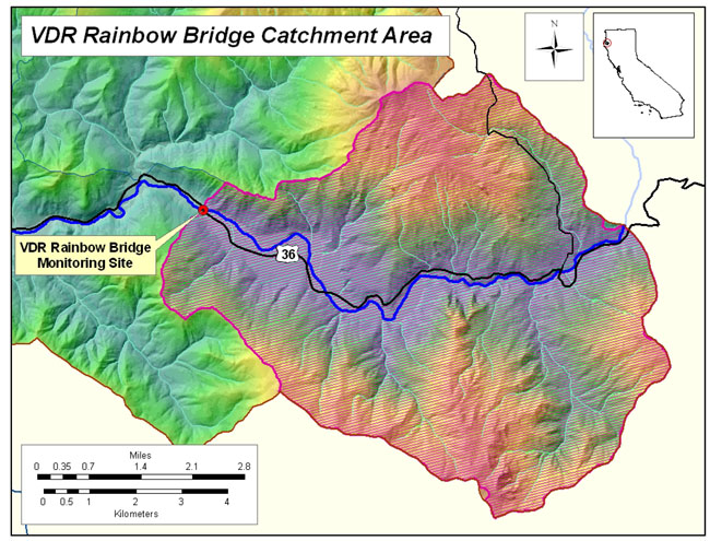
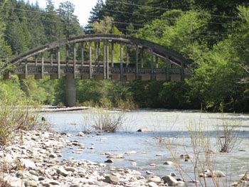
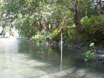
Driving east on Highway 36, Main Stem (MS) Rainbow
Bridge is the eastern-most monitoring site of the 11 sites within
the Van Duzen Watershed Project, and lies about one mile past
Grizzly Creek State Park. MS Rainbow Bridge is located on the
main stem Van Duzen River, adjacent the USGS/DWR discharge gauging
station, where project volunteers collected water samples during
the course of the project. The site is situated 40° 28.825'
North and 123° 53.440' West, and above the site, but within
the project boundary is a relatively large catchment area with
approximately 44.5 miles of stream network. Elevations in this
basin range from 364 feet at the base to over 3,100 feet in the
upper reaches, and the monitoring site is approximately 364 feet
in elevation. The catchment area for MS Rainbow Bridge is completely
in private ownership with a small amount of the timber holdings
and timber harvests operated by Humboldt Redwood Company (HWC,
formerly owned by PALCO) in the lower part of the watershed. Most
of the timber harvest activity in the catchment area is being
conducted by various private operators, including ranchers and
other landowners. As this area is beyond the alluvial plain favored
by coastal redwood, vegetation is predominantly mixed and evergreen
species dominated mostly by Fir and some Pine forest. The catchment
area of a monitoring site is important when considering upslope
factors that affect water quality in the stream. This area represents
the true watershed that lies above the point where water from
the stream is sampled, and from which all rainfall and sediment
are channeled into the stream down to the point where water is
withdrawn for turbidity and suspended sediment analysis.
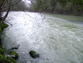
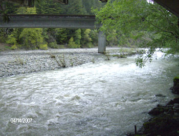
Stream discharge is directly proportional to the
size of the catchment area - the greater the area, the more water
is carried by the stream during storm events. Within the boundary
of the project MS Rainbow Bridge is the third largest of the 11
catchment areas, and above this point in the river, the catchment
area drains approximately 62.6 square kilometers which is equivalent
to 24.2 square miles. As samples are taken upstream from VDR Weares,
the MS Rainbow Bridge catchment area is contained within (overlaps)
the VDR Weares catchment area. During the first year of sampling
(HY07) volunteers recorded a maximum discharge of 6,930 cubic
feet per second (CFS) and an average discharge of 1,396 CFS, a
maximum turbidity of 820 Nephlometric Units (NTU) and an average
turbidity of 71 NTU. In HY08, there was a maximum discharge of
20,600 CFS and an average discharge of 1,861 CFS, a maximum turbidity
of 2,826 NTU and an average turbidity of 191 NTU over the winter
sampling season. Over the two seasons combined (HY07-HY08), the
maximum discharge was in HY08 at 20,600 CFS with an average of
1,650 CFS, maximum turbidity was also in HY08 at 2,826 NTU with
an average of 136 NTU. This translates to an average of 819 tons
of suspended sediment per square mile per year.
The main stem Van Duzen River runs year round
through most of the lower basin, and is therefore referred to
as a perennial stream (as opposed to an ephemeral stream, which
runs dry in the summer). However, in recent years, the stream
has begun to go dry, or goes underground in the alluvial plain
before it reaches the Eel River. These conditions are directly
due to the vast deposits of course sediment (sand, gravel, and
cobble) that have been deposited and continue to be deposited
in the river over time. Maximum weekly average temperature (MWAT)
in the summer of 2007 at MS Rainbow Bridge was 22.92 C, and in
2008 it was 21.75 C. Overall, temperatures were extremely high
compared to all of the other streams sampled within the lower
basin project area, higher than Yager Creek, which was the warmest
of all tributaries sampled within the lower basin, and even slightly
higher than VDR Weares downstream. MS Rainbow Bridge catchment
area has a road density of about 5.9 miles of roads per square
mile of watershed. As with all of the catchment areas within the
lower basin, this density of road networks receives a rating of
extremely high. In the 17-year period from 1991 through 2007,
the proportion of the area harvested for timber equaled 42.7%,
with clear cutting accounting for 3.5% of the total watershed
area. Similar to Yager Creek and VDR Weares, a large portion of
the MS Rainbow Bridge catchment area (in the eastern higher elevations)
is non-forest grassland and grazing land, which therefore makes
it difficult to quantify the impact of timber harvest in the forested
parts of the region which is primarily Fir forest.
|