Header
Funded by the California Water Quality Control Board, Integrated Watershed Management Program

Yager Creek
Sub Basin
Monitoring Sites


Yager Creek

Wolverton Gulch

Wilson Creek

Yager Creek Sub Basin
Wilson Creek Monitoring Site


Wilson Creek

Wilson Creek is located in the Van Duzen River Yager Subbasin at Latitude 40.64583 and Longitude 123.80056. Wilson Creek is an intermittent creek and flows during the Humboldt rainy seasons in the late fall and winter months. Wilson Creek originates in the Yager drainage, crosses Highway 36, runs through dairy fields, and empties into the main stem Van Duzen River in Carlotta.

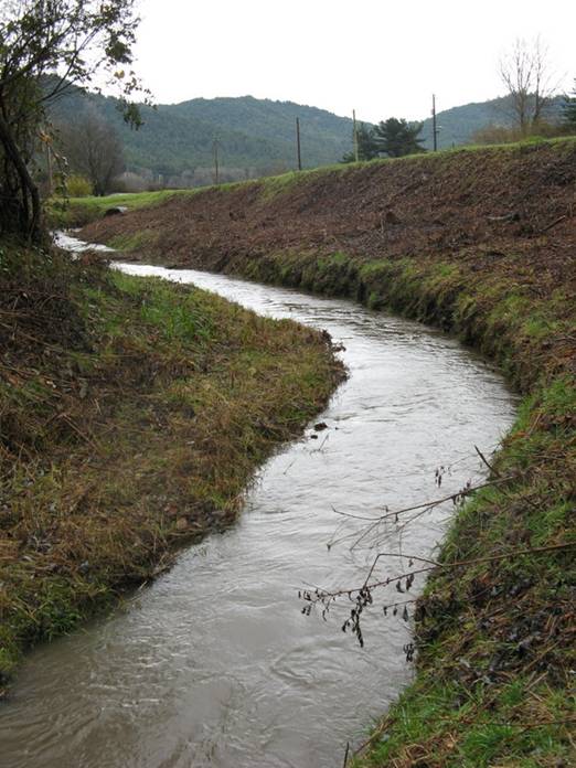
Our monitoring site is located near Highway 36 and is easily accessible. The California Highway Department has installed culverts along Highway 36 that feed into Wilson Creek and under the highway.  We have been monitoring Wilson Creek for the past two years at a spot just before the culverts enter Wilson Creek. During the rainy season, Wilson Creek rose to over 3.3 feet. In 2001, Chinook salmon were spotted in Wilson Creek.

The site has been monitored by Sal Steinberg, Field Manager, and Paul Mullan, a local high school student at the Academy of the Redwoods. As a young boy, Paul had played in the culverts which cross Highway 36 and using them as tunnels. As a teenager, now he monitored Wilson Creek for turbidity and discharge. Paul used his data from the Hydrologic Year 07 for his high school science fair project.

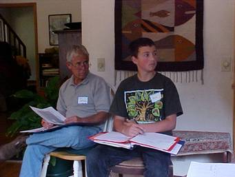
Jim Johnson and Paul Mullan at the Citizens’ Monitoring Group Training

For more information regarding data and analysis of Wilson Creek,
access the Van Duzen Watershed Project monitoring reports at www.fovd.org


Friends of the Van Duzen River
PO Box 315
Carlotta, CA 95528
Home | Educational Projects | Water Monitoring |
Water Quality Board |Salmon Watch | CDF